2:35 PM | *A couple interesting threats to monitor for the next week or so*
Paul Dorian

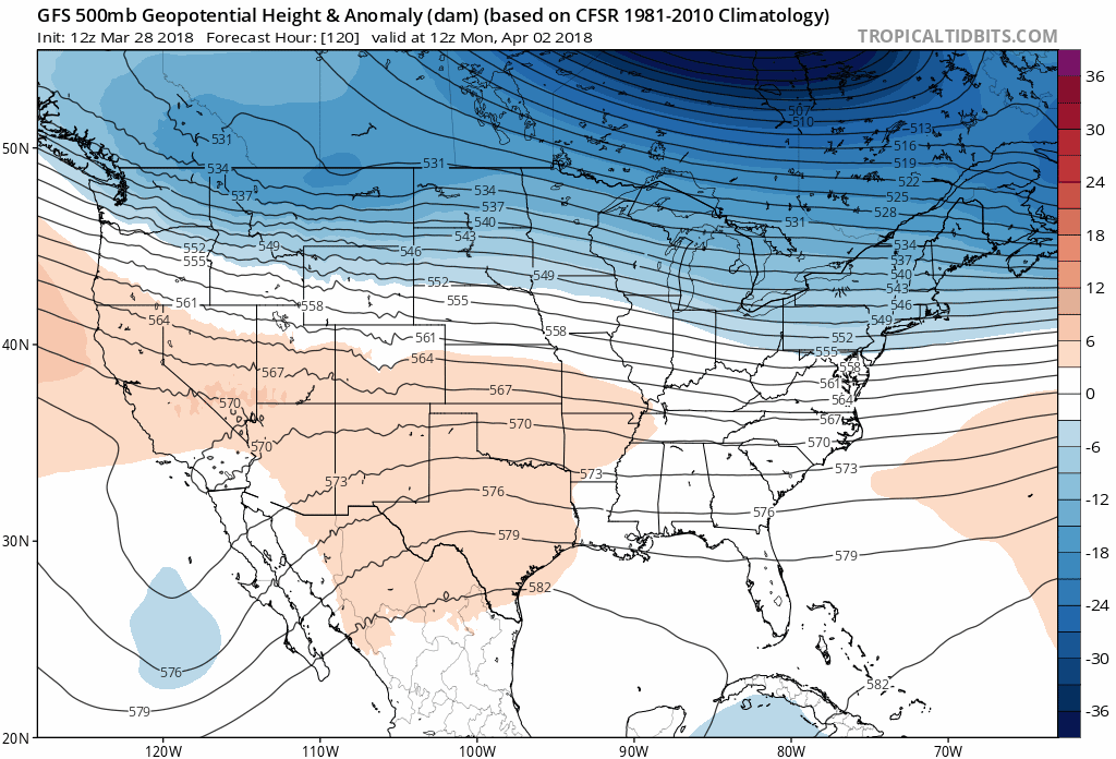
12Z GFS forecast maps of 500 mb height anomalies from Monday, April 2nd to Saturday, April 7th (hour 120 to hour 240); maps courtesy NOAA/EMC, tropicatidbits.com
Overview
There will be a noticeable warm up on Thursday in the I-95 corridor with 70+ degrees possible in the DC metro region and 60+ degrees in Philly, but then a cold front slides through the region on Friday and cooler air will arrive for the weekend. Another frontal system will arrive on Sunday and this will step us down a bit more in temperatures for the early part of next and there will be additional cold air outbreaks later next week. In addition to the colder pattern, we'll have at least a couple of low pressure systems to monitor in terms of snow for parts of the Mid-Atlantic region. One wave of low pressure could generate a swath of rain and/or snow on Monday and then a second - and perhaps stronger system - will need to be monitored for the latter part of next week or the following weekend.
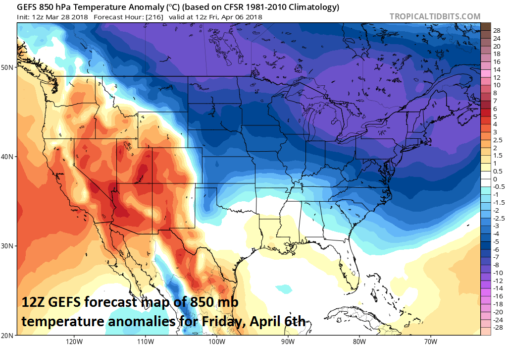
12Z GEFS forecast map of 850 mb temperature anomalies for Friday, April 6th; map courtesy NOAA/EMC, tropicaltidbits.com
Temperatures
At the same time the eastern US warms noticeably over the next couple of days, a much colder-than-normal air mass for this time of year will be building across central Canada. It is from this source region that cold air outbreaks will originate over the next couple of weeks before they drop to the south and east and likely result in numerous days around here with below-normal temperatures. Not every individual day will be colder-than-normal in the first ten days or so of April, but the average over the entire period is very likely to be below-normal in the DC-to-Philly-to-NYC corridor. A cold frontal system will push through the region on Friday and usher in the first wave of colder air for the upcoming weekend and then additional fronts will usher in progressively colder air masses going through next week.
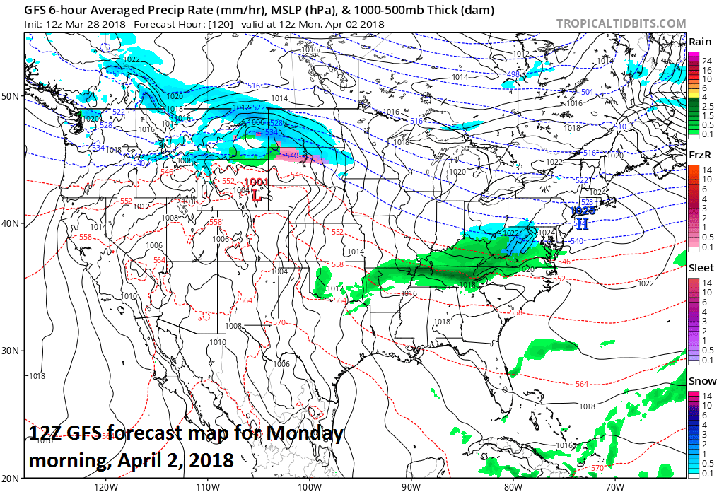
12Z GFS surface forecast map for Monday, April 2nd with low pressure pushing into the Mid-Atlantic region and snow is predicted (blue) in parts of the Mid-Atlantic region; map courtesy NOAA/EMC, tropicaltidbits.com
Snow threats
There will be a couple different low pressure systems to monitor next week as our pattern turns colder and snow cannot be ruled out with either system. On Monday, relatively weak low pressure will move in a generally west-to-east fashion and likely produce a swath of precipitation; primarily, to the south of the PA/MD border. There is an outside chance that it will be just cold enough for snow to fall in portions of the Mid-Atlantic region from this system including in the DC and Philly metro regions.

12Z GFS surface forecast map for Friday, April 6th with low pressure situated off the Mid-Atlantic coastline and a close call between rain and snow in the Mid-Atlantic region; map courtesy NOAA/EMC, tropicaltidbits.com
By late next week, strong upper-level energy may drop southeastward into the Northeast US at the same time very chilly air for this time of year moves into this area from central Canada. There are signs that strong low pressure may form off the Mid-Atlantic coastline by the end of next week or during the following weekend. If this happens, it could be cold enough for snow in parts of the Mid-Atlantic region. April 6th (Friday) just happens to be the anniversary date of the great April snowstorm in 1982 which caused blizzard conditions in New York City and other parts of the Northeast US and a foot or more of snow fell from Pennsylvania into New England.
Meteorologist Paul Dorian
Vencore, Inc.
vencoreweather.com
Morning video discussion: